1: The Polynesians were skilled at telling directions by stars and by the position of the rising or setting sun. The Chinese began to engineer an extensive system of inland waterways, some of which connected with the Pacific Ocean, to make long-distance transport of goods more convenient. The Greeks began to explore outside the mediterranean into the atlantic ocean. Early greek seafarers noticed a current running from north to south beyond Gibraltar. Some believed that only rivers had currents, they decided that this great mass of water was too wide to see across and they called this river okeanos.
2: Early mariners began to record information to make their voyages easier and safer-the location of rocks in a harbor, landmarks and the sailing times between them, the direction of currents. The first cartographers (chart makers) were probably mediterranean traders who made routine journeys from producing areas to markets. Their first charts (from about 800 B.C.) were drawn to jog their memory for obvious features along the route. The library constituted history's greatest accumulation of ancient writings. Written knowledge of all kinds-characteristics of nations, trade, natural wonders, artistic achievements, etc. When any ships entered harbor, the books (actually scrolls) contained law removed and copied. The library didn't survive the Roman period and the last librarian was Hypatia, the first notable woman Mathematician, Philosopher, and Scientist.
3: Prince Henry established a center at sagres for the study if marine science and navigation. Christopher Columbus "discovered" the New World quite by accident. His intention was to pioneer a sea route to the rich and fabled lands of the East.
4: Discuss the role of Captain James Cook in the history of marine science and be aware of his three major voyages. Captain Cook was sent on 3 specific voyages, charting and making maps of the areas he traveled as he went. The first voyage was to observe the movement and orbit of the planet Venus. The second voyage was a quest to look for the fabled continent of Antarctica, which he was never able to reach. The third voyage he traveled up the middle of the Pacific Ocean, and in such he had "discovered" Hawaii
5: Describe the United States Exploring Expedition,its objectives and accomplishments and its importance in bringing the United States into the field of oceanography. Lead by Charles Wilkes, the US felt that it was being left behind in marine science, and so founded the USEE expeditions. The main objective of the expeditions was to find new marine animals and to chart unknown waters. While it was rather successful, Wilkes' not-so-agreeable personality did not help the foundations funding.
6: Describe the Challenger expedition and its major contributions in marine science. The challenger was a British ship, whose specific goal was to expand on marine science. It was the first sailing expedition exclusively for marine science, observing many plants and animals of the sea. Its findings were so fast; that the information it recovered was published in 50 volumes of books, some of which are still used today. The expedition, however, would turn out to be a one-time voyage.
7: Chronicles the rise of land-based oceanographic institutions, from the early beginnings in Naples and Monaco to the major facilities now operating in the United States. The first land-based laboratory was in Naples, Italy. William Ritter wanted an oceanographic institution for the US, and with the help of EW Scripps and Browning Scripps, made the 1st institution in San Diego. Later, in Cape Cod on the other side of the States, the Woods Hole Oceanographic Institution was founded, which had immense growth during WWII.
8: List the disciplines in which marine research is being done today, as it relates to recent advances in data gathering and technology. There are many different disciplines of marine science, covering wide aspects of the different studies undertaken in the ocean. They range from four different and specific aspects of marine science: biological oceanography, chemical oceanography, geographical oceanography, and physical oceanography. Disciplines within these areas range from biogeochemistry, biogeography, coastal geography, environmental science, geophysics, glaciology, hydrography, hydrology, and limnology to meteorology. Each of these different branches of marine science focus on very specific and individual aspects of the oceans, from its geographical layout, to the life that lives within it, to its currents and physical properties.
Please Define
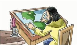
Cartography: A person who makes maps. This relates to marine science because someone in the marine science makes maps to show the location of where they are going and how to get there.
Celestial Navigation: The actions of finding one's way by observing the sun, moon, and stars. This helps the marine scientists find there way incase they are lost or confused.

Chart: A sheet of information in the form of a table, graph, or diagram. This helps because the scientists can tell what there is and how many by percentage.
Chronometer: A instrument for accurately measuring time.

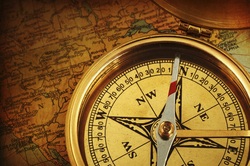
Compass: An instrument that points to magnetic North. This allows people on boats at sea to find their direction.
Dark Ages: The concept of a period of intellectual darkness and economic regression that supposedly occurred in Europe following the collapse of the Western Roman Empire. This was a period of great oceanographic exploration.
Echo Sounder: A device that bounces sound waves off of the ocean bottom. This allows for the mapping of the geographical bottom of the ocean.
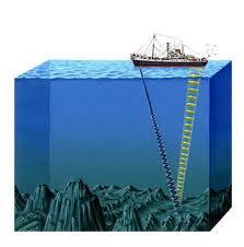
Sounding: Depth measurements of the ocean. This allows for ships to know where it is okay to travel and where it is too shallow.
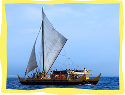
Voyaging: Traveling on the ocean for a specific purpose. This relates to marine science in that in order to carry out studies of the oceans, you need to actually venture out into the ocean.
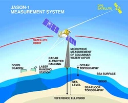
Satellite Oceanography: The use of satellites to study the ocean in remote locations or the oceans surface. This allows marine scientists to gather vast amounts of data remotely.
Renaissance: The Renaissance was a cultural movement that profoundly affected European intellectual life in the early modern period. This was a period of great discovery, much over the oceans.

Oceanographic Institute: A place specifically devoted to the study of the ocean. This is where marine science is conducted.

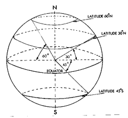
Longitude: Lines drawn (on a map) from pole to pole. This allows for the easy mapping of the world and the oceans.
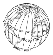
Latitude: Lines drawn (on a map) parallel to the equator. This allows the easy mapping of the world and the oceans.
GPS (Global Positioning System): A device using satellites in orbit to determine position on Earth. This helps marine scientists to find their way at sea, and keep track of important locations.
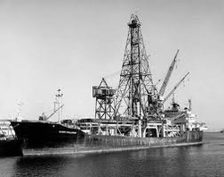
Glomar Challenger: A deep-sea research and scientific drilling vessel for oceanography and marine geology studies. It was a boat specifically designed to study the oceans.